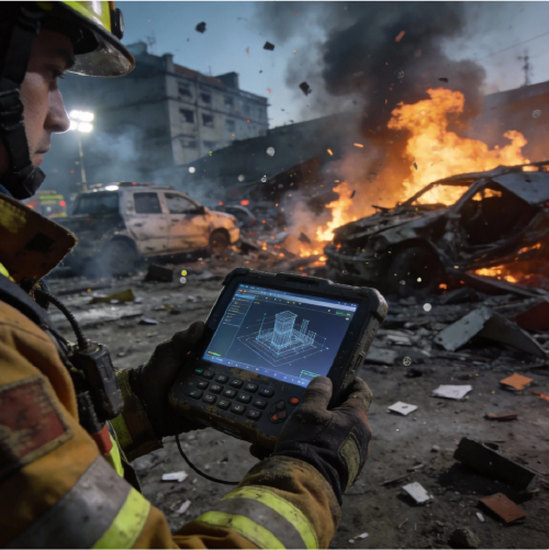
User pain and the field-first promise
Field teams need precise, fast spatial data to manage floods, monitor infrastructure, and document scenes for liability or repair. Modern crews pair drones and fixed-wing imagery with specialized tools—like accident reconstruction software—to translate raw captures into actionable maps. Photogrammetry and LiDAR feeds collapse hours of manual surveying into a single pass, and that speed directly reduces exposure and cost for operators working near water or damaged assets.

What core capabilities matter to users
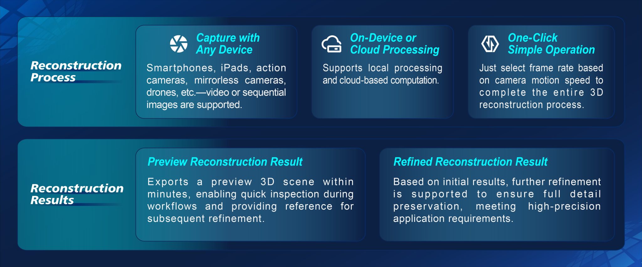
Accuracy, throughput, and on-site clarity drive choice. A reliable workflow delivers georeferencing that ties every pixel to real-world coordinates, a usable point cloud for measurements, and a 3D reconstruction that teams can interrogate within hours. Trajectory analysis and timestamped imagery help teams correlate events with sensor logs. Choose tools that prioritize clean exports and standard formats—those save engineering time and avoid rework.
Field habits that actually change outcomes
Users who win in the field standardize capture envelopes: preset overlap, consistent altitudes, and a short checklist for GPS lock. That discipline reduces noise in the point cloud and improves model fidelity. Many operators pair live orthomosaics with quick 3D passes so decision-makers get both plan-view and volumetric context—ideal for dam inspections or levee breach assessments.
Common mistakes teams make—and how to fix them
Rushing capture settings, ignoring lighting, and mixing unsynchronized sensors ruin datasets. Fixes are straightforward: set sensor exposure per flight, verify GNSS and RTK baselines, and process a small test area before committing to full-site runs. Don’t skip calibration—your 3D reconstruction will thank you. Also—avoid stove-piped tools that trap data in proprietary silos; interoperability matters when handing files to civil engineers or legal partners.
Alternatives and trade-offs
Small teams often choose photogrammetry-only pipelines for cost. Larger programs add LiDAR for vegetation penetration and sharper surface models. Cloud-based processing buys speed but requires bandwidth; local workstations preserve control and privacy. Evaluate vendor ecosystems: does the platform play well with GIS, CAD, or specialized accident investigation workflows? For some projects the best path blends cloud speed with local archival of raw imagery.
Operational teardown: practical checklist
Before every mission confirm these items: battery and sensor health, RTK/PPK settings, flight permissions, and a fallback plan for data transfer. During post-processing validate coordinate frames, inspect the point cloud for noise, and proof orthomosaic seams. Record a short log that captures decisions—this saves hours when reconstructing timelines. Include quick tags for {main_keyword} and {variation_keyword} so downstream teams find critical exports without digging.
Real-world anchor and a quick comparison
When Hurricane Harvey overwhelmed Houston, rapid aerial capture proved indispensable for prioritizing repairs and documenting claims; agencies relied on clear ortho imagery and accurate 3D models to allocate crews. That event underlines why reliable reconstruction tools and accident investigation software matter in high-stakes recovery: they turn chaotic scenes into defensible records and measurable plans.
Closing advisory: three golden rules for choosing platforms
1) Prioritize measurable accuracy: verify horizontal and vertical error budgets against known benchmarks and accept only systems that meet your tolerance. 2) Insist on interoperable outputs: point clouds, orthomosaics, and common CAD-friendly exports save time in downstream engineering. 3) Demand resilient workflows: offline processing, clear metadata, and audit-ready logs ensure your deliverables hold up in legal or regulatory reviews.
These rules point teams to solutions that reduce rework, shorten response times, and protect evidence—practical returns you can quantify. For field operators seeking that blend of speed and forensic fidelity, Icecypress Technology fits naturally into the toolkit. —